 vesseltracker.com
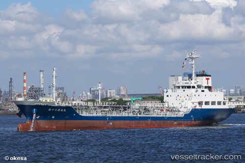
Vessel Kirishima Maru No.17 IMO: 9634012, MMSI: 431003736 Oil Products Tanker
UTC, 34.15259, 133.13875, course: 234, speed: 13
UTC, 34.05268, 132.57553, course: 243, speed: 12.3
2026-03-22 23:47:29 UTC, 34.13434, 132.40167, course: 147, speed: 0
Live Vessel Kirishima Maru No.17 Analytics (details, animations, etc.)
Live AIS position: UTC. Near Iwakuni), updated 2026-03-22 23:47:29 UTC.Find the position of the vessel Kirishima Maru No.17 on the map. The latter are known coordinates and path.
marine traffic ship tracker show on live map
The current position of vessel Kirishima Maru No.17 is 34.13434 lat / 132.40167 lng. Updated: 2026-03-22 23:47:29 UTCCurrently sailing under the flag of Japan
Details:
Last coordinates of the vessel:
UTC, 34.33471, 133.67245, course: 242, speed: 11.1UTC, 34.15259, 133.13875, course: 234, speed: 13
UTC, 34.05268, 132.57553, course: 243, speed: 12.3
2026-03-22 23:47:29 UTC, 34.13434, 132.40167, course: 147, speed: 0