 vesseltracker.com
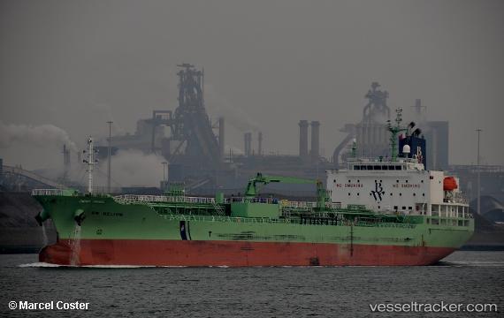
Vessel LAVENDER RAY IMO: 9740794, MMSI: 636019177 Chemical/Oil Products Tanker
UTC, 40.91167, -19.14500, course: -1, speed: 11
UTC, 40.72667, -19.63500, course: -1, speed: 11
2026-02-27 15:35:48 UTC, 40.54333, -20.09166, course: -1, speed: 12
Live AIS position:
UTC. 123 nm SE of Arnedillo),
updated 2026-02-27 15:35:48 UTC.
Find the position of the vessel LAVENDER RAY on the map. The latter are known coordinates and path.
marine traffic ship tracker show on live map
The current position of vessel LAVENDER RAY is 40.54333 lat / -20.09166 lng. Updated: 2026-02-27 15:35:48 UTCCurrently sailing under the flag of Liberia
LAVENDER RAY built in 2017 year
Deadweight:
19994 tDetails:
Last coordinates of the vessel:
UTC, 40.99333, -18.92667, course: -1, speed: 12UTC, 40.91167, -19.14500, course: -1, speed: 11
UTC, 40.72667, -19.63500, course: -1, speed: 11
2026-02-27 15:35:48 UTC, 40.54333, -20.09166, course: -1, speed: 12