 vesseltracker.com
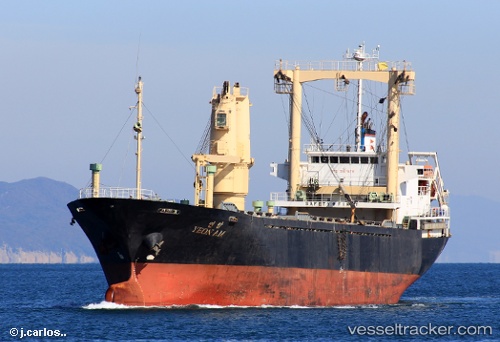
Vessel LEO IMO: 9167679, MMSI: 341289002 General Cargo
UTC, 22.82927, 69.99292, course: -1, speed: 0
UTC, 22.82927, 69.99269, course: -1, speed: 0
2026-03-04 02:26:27 UTC, 22.82930, 69.99270, course: -1, speed: 0
Live AIS position:
UTC. 14 nm E of Mundra Port SEZ),
updated 2026-03-04 02:26:27 UTC.
Find the position of the vessel LEO on the map. The latter are known coordinates and path.
marine traffic ship tracker show on live map
The current position of vessel LEO is 22.82930 lat / 69.99270 lng. Updated: 2026-03-04 02:26:27 UTCCurrently sailing under the flag of Saint Kitts and Nevis
Details:
Last coordinates of the vessel:
UTC, 22.83027, 69.99476, course: -1, speed: 0UTC, 22.82927, 69.99292, course: -1, speed: 0
UTC, 22.82927, 69.99269, course: -1, speed: 0
2026-03-04 02:26:27 UTC, 22.82930, 69.99270, course: -1, speed: 0