 vesseltracker.com
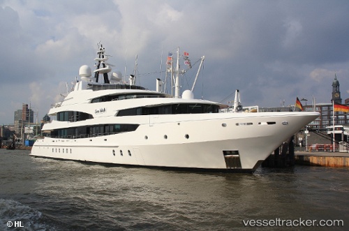
Vessel LUDZIE IMO: 1008530, MMSI: 256577000 Yacht
UTC, 24.20071, -76.51281, course: 22, speed: 0.5
UTC, 24.20075, -76.51258, course: 310, speed: 0.1
2026-02-24 19:27:12 UTC, 24.20084, -76.51325, course: 9, speed: 0.1
Live AIS position:
UTC. 30 nm NW of Bock Cay),
updated 2026-02-24 19:27:12 UTC.
Find the position of the vessel LUDZIE on the map. The latter are known coordinates and path.
marine traffic ship tracker show on live map
The current position of vessel LUDZIE is 24.20084 lat / -76.51325 lng. Updated: 2026-02-24 19:27:12 UTCCurrently sailing under the flag of Malta
Details:
Last coordinates of the vessel:
UTC, 24.33692, -76.73199, course: 117, speed: 9.4UTC, 24.20071, -76.51281, course: 22, speed: 0.5
UTC, 24.20075, -76.51258, course: 310, speed: 0.1
2026-02-24 19:27:12 UTC, 24.20084, -76.51325, course: 9, speed: 0.1