 vesseltracker.com
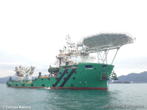
Vessel La Bamba IMO: 9680762, MMSI: 345070056 Offshore Support Vessel
UTC, 22.22403, -97.83692, course: 9, speed: 0
UTC, 22.22409, -97.83686, course: 10, speed: 0
2026-02-20 03:38:55 UTC, 22.22408, -97.83688, course: 10, speed: 0
Live AIS position:
UTC. Near Benito Juarez),
updated 2026-02-20 03:38:55 UTC.
Find the position of the vessel La Bamba on the map. The latter are known coordinates and path.
marine traffic ship tracker show on live map
The current position of vessel La Bamba is 22.22408 lat / -97.83688 lng. Updated: 2026-02-20 03:38:55 UTCCurrently sailing under the flag of Mexico
Details:
Last coordinates of the vessel:
UTC, 22.22414, -97.83688, course: 9, speed: 0UTC, 22.22403, -97.83692, course: 9, speed: 0
UTC, 22.22409, -97.83686, course: 10, speed: 0
2026-02-20 03:38:55 UTC, 22.22408, -97.83688, course: 10, speed: 0