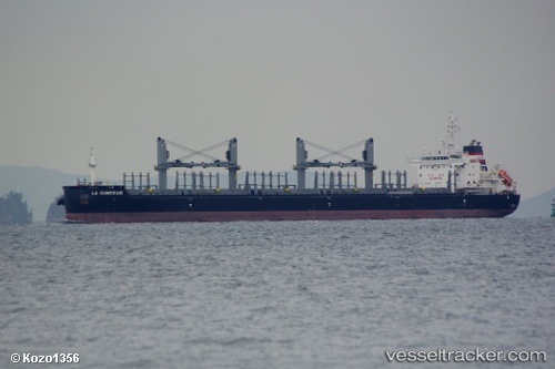
vessel La Guimorais IMO: 9618018, Bulk Carrier
vesseltracker.com
Vessel La Guimorais IMO: 9618018, Bulk Carrier
MMSI: 229530000 callsign: 9HA3382 size: 30x180

Find the position of the vessel La Guimorais on the map. The latter are known coordinates and path.

marine traffic ship tracker show on live map

The current position of vessel La Guimorais is 35.0824 lat / 129.091 lng. Updated: 2022-10-20 00:17:43 UTC
Details:


Last coordinates of the vessel:
2022-10-20 00:17:43 UTC, 35.0824, 129.091, course: 328, speed: 0.1

Track of the vessel in the last 14 days


Most frequent ports a vessels calls at La Guimorais (229530000):

Whangarei, traffic: 6
Gladstone Harbor, traffic: 4
Nelson, traffic: 4
Wusong, traffic: 2
Newcastle, traffic: 2
Noumea, traffic: 2
Thursday Island, traffic: 2
Sriracha, traffic: 2
Geelong, traffic: 2
Torres Strait, traffic: 2
Whyalla, traffic: 2
Wilson Promontory, traffic: 2
Wu-Sung, traffic: 2
Zamboanga, traffic: 1
Pei-Hai, traffic: 1

Link to the map:


Find another ship

La_Guimorais (229530000) last ports (portcalls and passsages)

Busan | 2022-10-18 07:14:54
Lianyungang | 2022-10-01 07:04:48
Pei-Hai | 2022-09-24 22:53:18
Zamboanga | 2022-09-15 08:05:39
Whangarei | 2022-07-07 13:45:50
Whangarei | 2022-07-03 10:49:14
Nelson | 2022-06-30 10:50:21
Nelson | 2022-06-26 10:22:51
New Plymouth | 2022-06-21 22:23:32
Manila | 2022-06-04 01:17:48
Whangarei | 2022-05-02 12:19:31
Whangarei | 2022-04-16 17:59:40
Nelson | 2022-04-12 09:05:12
Whyalla | 2022-03-30 11:23:55
Wilson Promontory | 2022-03-27 21:04:09
Gladstone Harbor | 2022-03-22 23:50:23
Geelong | 2022-03-08 08:52:54
Gladstone Harbor | 2022-02-28 18:10:31
Noumea | 2022-02-17 18:06:53
Newcastle | 2022-02-12 00:37:40
Thursday Island | 2022-01-29 20:11:27
Sriracha | 2022-01-06 04:21:51
Wu-Sung | 2021-12-24 10:30:39
Whangarei | 2021-12-01 00:23:14