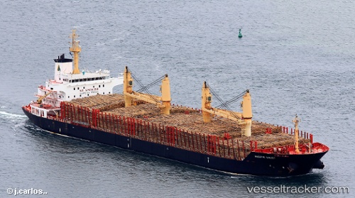
vessel Labrador Strait IMO: 9526564, Bulk Carrier
vesseltracker.com
Vessel Labrador Strait IMO: 9526564, Bulk Carrier
MMSI: 636091813 callsign: A8TC2 size: 181x30

Find the position of the vessel Labrador Strait on the map. The latter are known coordinates and path.

marine traffic ship tracker show on live map

Currently sailing under the flag of Liberia

Labrador Strait built in 2010 year

Deadweight:
34000 t

Payload_mass:
34000 tonne
Gross tonnage:
22636
Service entry:
2010-01-01T00:00:00Z
Details:


Track of the vessel in the last 14 days


Most frequent ports a vessels calls at Labrador Strait (636091813):

Nansha, traffic: 4
Richmond, traffic: 4
Chittagong, traffic: 3
Selat Wetar, traffic: 3
Torres Strait, traffic: 3
Whangarei, traffic: 3
Oakland, traffic: 3
San Francisco, traffic: 2
Geraldton, traffic: 2
Selat Lombok, traffic: 2
Huang Pu, traffic: 2
Huang-Pu, traffic: 2
Makassar, traffic: 2
Napieir, traffic: 2
Whampoa, traffic: 2

Link to the map:


Find another ship

Labrador_Strait (636091813) last ports (portcalls and passsages)

Whangarei | 2022-09-26 01:02:03
Whangarei | 2022-09-21 22:52:02
Torres Strait | 2022-09-13 16:51:18
Selat Wetar | 2022-09-10 01:41:36
Sambu | 2022-09-03 10:33:26
Chittagong | 2022-08-11 16:03:02
Chittagong | 2022-08-07 14:05:02
Chittagong | 2022-08-03 10:32:00
Singapore | 2022-07-24 07:09:33
Busan | 2022-07-14 07:44:30
San Francisco | 2022-06-27 07:10:38
Richmond | 2022-06-23 11:00:27
Richmond | 2022-06-19 10:20:25
Richmond | 2022-06-15 10:10:55
Oakland | 2022-06-15 01:12:25
Oakland | 2022-06-10 23:10:45
Benicia | 2022-06-10 19:46:10
Benicia | 2022-05-30 22:03:30
Oakland | 2022-05-30 19:32:21
Whangarei | 2022-02-26 17:17:20
Napieir | 2022-02-19 05:49:40
Port Taranaki | 2022-02-07 15:58:47
Torres Strait | 2022-01-29 16:58:44
Nansha | 2022-01-20 06:46:10
Huang Pu | 2022-01-17 05:05:18
Nansha | 2022-01-17 02:42:08
Zamboanga | 2022-01-11 21:25:02
Selat Wetar | 2021-12-24 11:16:37
Makassar | 2021-12-09 11:26:55
Selat Lombok | 2021-12-08 09:05:31
Geraldton | 2021-12-02 01:01:58