 vesseltracker.com
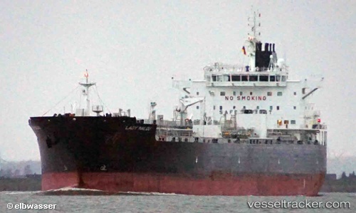
Vessel Lady Malou IMO: 9590723, MMSI: 241236000 Chemical Oil Products Tanker
Live AIS position:
UTC. Near Colon),
updated 2024-05-09 15:37:02 UTC.
Find the position of the vessel Lady Malou on the map. The latter are known coordinates and path.
marine traffic ship tracker show on live map
The current position of vessel Lady Malou is 9.37355 lat / -79.93325 lng. Updated: 2024-05-09 15:37:02 UTCCurrently sailing under the flag of Greece
Lady Malou built in 2013 year
Deadweight:
51486 tDetails:
Last coordinates of the vessel:
2024-05-09 15:37:02 UTC, 9.37355, -79.93325, course: 253, speed: 0