 vesseltracker.com
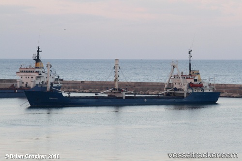
Vessel Lady Rasha IMO: 7223041, MMSI: 677030700 Livestock Carrier
UTC, 45.45979, 28.24394, course: 303, speed: 0
UTC, 45.45981, 28.24396, course: 298, speed: 0
2026-02-21 19:46:55 UTC, 45.45972, 28.24388, course: 307, speed: 0
Live AIS position:
UTC. Near Giurgiulesti),
updated 2026-02-21 19:46:55 UTC.
Find the position of the vessel Lady Rasha on the map. The latter are known coordinates and path.
marine traffic ship tracker show on live map
The current position of vessel Lady Rasha is 45.45972 lat / 28.24388 lng. Updated: 2026-02-21 19:46:55 UTCCurrently sailing under the flag of Tanzania
Lady Rasha built in 1972 year
Deadweight:
2995 tDetails:
Last coordinates of the vessel:
UTC, 45.45978, 28.24394, course: 301, speed: 0UTC, 45.45979, 28.24394, course: 303, speed: 0
UTC, 45.45981, 28.24396, course: 298, speed: 0
2026-02-21 19:46:55 UTC, 45.45972, 28.24388, course: 307, speed: 0