 vesseltracker.com
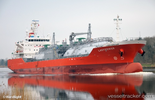
Vessel Ladybower IMO: 9798947, MMSI: 563036300 Lpg Tanker
UTC, 18.59764, -83.33328, course: 323, speed: 14.9
UTC, 19.09667, -83.70333, course: -1, speed: 15
2026-02-21 16:30:37 UTC, 19.61333, -84.09167, course: -1, speed: 15
Live AIS position:
UTC. 133 nm N of Swan Island),
updated 2026-02-21 16:30:37 UTC.
Find the position of the vessel Ladybower on the map. The latter are known coordinates and path.
marine traffic ship tracker show on live map
The current position of vessel Ladybower is 19.61333 lat / -84.09167 lng. Updated: 2026-02-21 16:30:37 UTCCurrently sailing under the flag of Singapore
Details:
Last coordinates of the vessel:
UTC, 18.41333, -83.19500, course: -1, speed: 15UTC, 18.59764, -83.33328, course: 323, speed: 14.9
UTC, 19.09667, -83.70333, course: -1, speed: 15
2026-02-21 16:30:37 UTC, 19.61333, -84.09167, course: -1, speed: 15