 vesseltracker.com
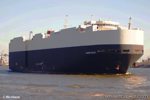
Vessel Lake Kivu IMO: 9308792, MMSI: 636015993 Vehicles Carrier
UTC, 43.42087, 7.68822, course: 51, speed: 13.4
UTC, 43.72320, 8.24305, course: 52, speed: 13.3
2026-02-22 09:51:09 UTC, 43.97733, 8.71360, course: 52, speed: 13.6
Live AIS position:
UTC. 18 nm SE of Noli),
updated 2026-02-22 09:51:09 UTC.
Find the position of the vessel Lake Kivu on the map. The latter are known coordinates and path.
marine traffic ship tracker show on live map
The current position of vessel Lake Kivu is 43.97733 lat / 8.71360 lng. Updated: 2026-02-22 09:51:09 UTCCurrently sailing under the flag of Liberia
Lake Kivu built in 2006 year
Deadweight:
12322 tDetails:
Last coordinates of the vessel:
UTC, 43.27685, 7.43705, course: 51, speed: 13.6UTC, 43.42087, 7.68822, course: 51, speed: 13.4
UTC, 43.72320, 8.24305, course: 52, speed: 13.3
2026-02-22 09:51:09 UTC, 43.97733, 8.71360, course: 52, speed: 13.6