 vesseltracker.com
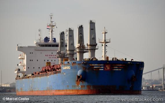
Vessel Lampard IMO: 9723980, MMSI: 563043700 Bulk Carrier
UTC, 22.63771, 59.47590, course: 322, speed: 0.1
UTC, 22.63726, 59.47482, course: 4, speed: 0.2
2026-02-23 07:48:50 UTC, 22.63736, 59.47429, course: 22, speed: 0.1
Live AIS position:
UTC. Near SUR),
updated 2026-02-23 07:48:50 UTC.
Find the position of the vessel Lampard on the map. The latter are known coordinates and path.
marine traffic ship tracker show on live map
The current position of vessel Lampard is 22.63736 lat / 59.47429 lng. Updated: 2026-02-23 07:48:50 UTCDetails:
Last coordinates of the vessel:
UTC, 22.63819, 59.47639, course: 295, speed: 0.1UTC, 22.63771, 59.47590, course: 322, speed: 0.1
UTC, 22.63726, 59.47482, course: 4, speed: 0.2
2026-02-23 07:48:50 UTC, 22.63736, 59.47429, course: 22, speed: 0.1