 vesseltracker.com
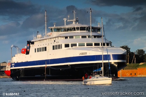
Vessel Landegode IMO: 9607370, MMSI: 259987000 Passenger Ro Ro Cargo Ship
UTC, 67.27890, 14.33088, course: 248, speed: 17.6
UTC, 67.56021, 13.02323, course: 307, speed: 17.6
2026-02-23 17:56:24 UTC, 67.52724, 12.44122, course: 230, speed: 17.2
Live AIS position:
UTC. Near Røst),
updated 2026-02-23 17:56:24 UTC.
Find the position of the vessel Landegode on the map. The latter are known coordinates and path.
marine traffic ship tracker show on live map
The current position of vessel Landegode is 67.52724 lat / 12.44122 lng. Updated: 2026-02-23 17:56:24 UTCCurrently sailing under the flag of Norway
Landegode built in 2012 year
Deadweight:
650 tDetails:
Last coordinates of the vessel:
UTC, 67.28846, 14.39286, course: 275, speed: 0UTC, 67.27890, 14.33088, course: 248, speed: 17.6
UTC, 67.56021, 13.02323, course: 307, speed: 17.6
2026-02-23 17:56:24 UTC, 67.52724, 12.44122, course: 230, speed: 17.2