 vesseltracker.com
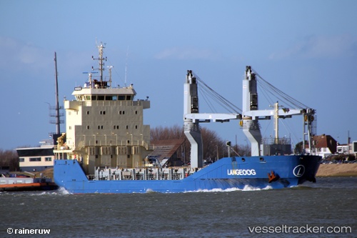
Vessel Langeoog IMO: 9506136, MMSI: 305973000 Multi Purpose Carrier
UTC, 27.98333, -29.99333, course: -1, speed: 8
UTC, 27.98167, -30.34167, course: -1, speed: 8
2026-02-23 15:37:43 UTC, 27.97667, -30.58167, course: -1, speed: 8
Live AIS position:
UTC. 107 nm SW of Tarpon Springs),
updated 2026-02-23 15:37:43 UTC.
Find the position of the vessel Langeoog on the map. The latter are known coordinates and path.
marine traffic ship tracker show on live map
The current position of vessel Langeoog is 27.97667 lat / -30.58167 lng. Updated: 2026-02-23 15:37:43 UTCCurrently sailing under the flag of Antigua Barbuda
Details:
Last coordinates of the vessel:
UTC, 27.98667, -29.58667, course: -1, speed: 9UTC, 27.98333, -29.99333, course: -1, speed: 8
UTC, 27.98167, -30.34167, course: -1, speed: 8
2026-02-23 15:37:43 UTC, 27.97667, -30.58167, course: -1, speed: 8