 vesseltracker.com
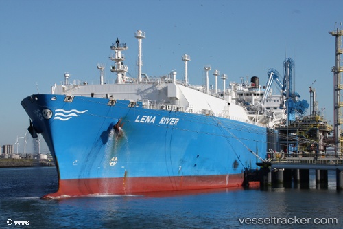
Vessel Lena River IMO: 9629598, MMSI: 538005073 Lng Tanker
UTC, -33.79708, 16.43275, course: 322, speed: 8.4
UTC, -33.59589, 16.26919, course: 322, speed: 8.3
2026-03-03 23:58:47 UTC, -33.30335, 16.00669, course: 319, speed: 8.4
Live AIS position:
UTC. 95 nm W of Saldanha Bay),
updated 2026-03-03 23:58:47 UTC.
Find the position of the vessel Lena River on the map. The latter are known coordinates and path.
marine traffic ship tracker show on live map
The current position of vessel Lena River is -33.30335 lat / 16.00669 lng. Updated: 2026-03-03 23:58:47 UTCDetails:
Last coordinates of the vessel:
UTC, -33.99550, 16.62648, course: 316, speed: 8.3UTC, -33.79708, 16.43275, course: 322, speed: 8.4
UTC, -33.59589, 16.26919, course: 322, speed: 8.3
2026-03-03 23:58:47 UTC, -33.30335, 16.00669, course: 319, speed: 8.4