 vesseltracker.com
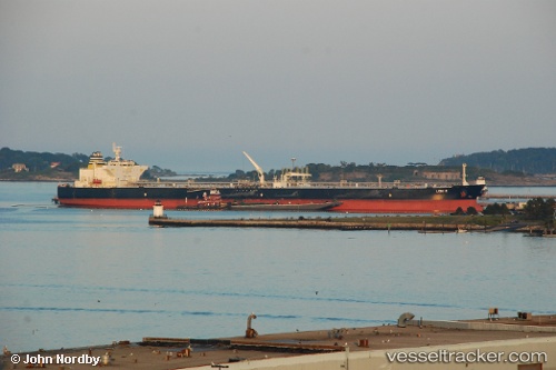
Vessel Leni P IMO: 9594133, MMSI: 538008334 Crude Oil Tanker
UTC, 18.95313, 38.99076, course: 140, speed: 8.3
UTC, 18.95313, 38.99076, course: 140, speed: 8.3
2026-03-01 12:35:57 UTC, 18.95313, 38.99076, course: 140, speed: 8.3
Live AIS position:
UTC. 93 nm E of OSMAN DIGNA),
updated 2026-03-01 12:35:57 UTC.
Find the position of the vessel Leni P on the map. The latter are known coordinates and path.
marine traffic ship tracker show on live map
The current position of vessel Leni P is 18.95313 lat / 38.99076 lng. Updated: 2026-03-01 12:35:57 UTCCurrently sailing under the flag of Marshall Is
Leni P built in 2011 year
Deadweight:
158640 tDetails:
Last coordinates of the vessel:
UTC, 18.96879, 38.97247, course: 99, speed: 2.4UTC, 18.95313, 38.99076, course: 140, speed: 8.3
UTC, 18.95313, 38.99076, course: 140, speed: 8.3
2026-03-01 12:35:57 UTC, 18.95313, 38.99076, course: 140, speed: 8.3