vessel AFRODITA I IMO: 9410234, Crude Oil Tanker vesseltracker.com
Vessel AFRODITA I IMO: 9410234, Crude Oil Tanker
MMSI: 352001522 callsign: 3E2533 size: 333x333

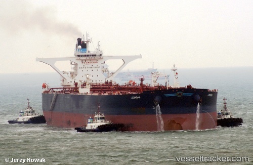
Find the position of the vessel AFRODITA I on the map. The latter are known coordinates and path.

marine traffic ship tracker show on live map

The current position of vessel AFRODITA I is -35.1791 lat / 20.4748 lng. Updated: 2024-05-08 14:27:16 UTC

Currently sailing under the flag of Panama

AFRODITA I built in 2009 year

Deadweight:
318325 t

Payload_mass:
318325 tonne
Gross tonnage:
160502
Service entry:
2009-01-01T00:00:00Z

Manufacturer:
Hyundai Heavy Industries (company)

Details:


Last coordinates of the vessel:
UTC, -35.2047, 19.7399, course: 89, speed: 12
UTC, -35.1867, 20.1833, course: -1, speed: 12
UTC, -35.1817, 20.3384, course: 88, speed: 12
2024-05-08 14:27:16 UTC, -35.1791, 20.4748, course: 86, speed: 11.9

Track of the vessel in the last 14 days


Most frequent ports a vessels calls at AFRODITA I (352001522):

Sambu, traffic: 6
Singapore, traffic: 6
Fujairah, traffic: 2
Port Louis, traffic: 2
Sabang, traffic: 2
Strait Of Gibraltar, traffic: 1
Mina Az Zawr, traffic: 1
Bur Ibrahim, traffic: 1
Ra’S Shukhayr, traffic: 1

Link to the map:


Find another ship

AFRODITA_I (352001522) last ports (portcalls and passsages)

Strait Of Gibraltar | 2024-04-19 15:26:08
Bur Ibrahim | 2024-04-02 03:48:06
Ra’S Shukhayr | 2024-03-31 16:34:50
Singapore | 2023-10-16 00:21:34
Sambu | 2023-04-09 21:33:29
Singapore | 2022-05-24 01:30:17
Mina Az Zawr | 2022-04-16 04:06:37
Fujairah | 2022-04-10 06:35:23
Singapore | 2022-02-17 06:45:06
Port Louis | 2021-12-18 04:35:01
Sabang | 2021-12-06 18:39:15
Singapore | 2021-12-03 11:48:02