 vesseltracker.com
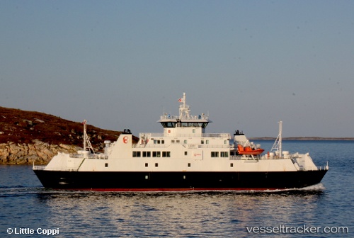
Vessel Luroey IMO: 9221047, MMSI: 257127000 Passenger Ro Ro Cargo Ship
UTC, 66.39325, 12.82589, course: 243, speed: 0.7
UTC, 66.36915, 12.37092, course: 219, speed: 0
2026-02-27 02:05:18 UTC, 66.37127, 12.80289, course: 303, speed: 12.7
Live AIS position:
UTC. Near Lurøy),
updated 2026-02-27 02:05:18 UTC.
Find the position of the vessel Luroey on the map. The latter are known coordinates and path.
marine traffic ship tracker show on live map
The current position of vessel Luroey is 66.37127 lat / 12.80289 lng. Updated: 2026-02-27 02:05:18 UTCCurrently sailing under the flag of Norway
Details:
Last coordinates of the vessel:
UTC, 66.41384, 12.56918, course: 112, speed: 11.2UTC, 66.39325, 12.82589, course: 243, speed: 0.7
UTC, 66.36915, 12.37092, course: 219, speed: 0
2026-02-27 02:05:18 UTC, 66.37127, 12.80289, course: 303, speed: 12.7