 vesseltracker.com
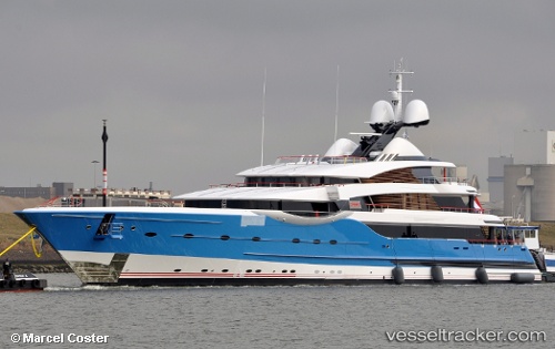
Vessel MADAME GU IMO: 1011331, MMSI: 319906000 Yacht
UTC, 25.26252, 55.28300, course: 32, speed: 0
UTC, 25.26250, 55.28300, course: 33, speed: 0
2026-02-21 21:42:31 UTC, 25.26251, 55.28300, course: 32, speed: 0
Live AIS position:
UTC. Near Mina Rashid Port),
updated 2026-02-21 21:42:31 UTC.
Find the position of the vessel MADAME GU on the map. The latter are known coordinates and path.
marine traffic ship tracker show on live map
The current position of vessel MADAME GU is 25.26251 lat / 55.28300 lng. Updated: 2026-02-21 21:42:31 UTCCurrently sailing under the flag of Cayman Islands
MADAME GU built in 2013 year
Deadweight:
549 tDetails:
Last coordinates of the vessel:
UTC, 25.26251, 55.28299, course: 33, speed: 0UTC, 25.26252, 55.28300, course: 32, speed: 0
UTC, 25.26250, 55.28300, course: 33, speed: 0
2026-02-21 21:42:31 UTC, 25.26251, 55.28300, course: 32, speed: 0