 vesseltracker.com
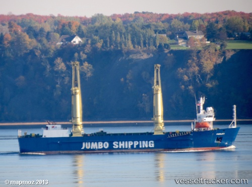
Vessel MAHER IMO: 8806905, MMSI: 677023800 Heavy Load Carrier
Live AIS position:
UTC. Near Mithivirdi),
updated 2024-11-27 18:23:47 UTC.
Find the position of the vessel MAHER on the map. The latter are known coordinates and path.
marine traffic ship tracker show on live map
The current position of vessel MAHER is 21.42607 lat / 72.21484 lng. Updated: 2024-11-27 18:23:47 UTCCurrently sailing under the flag of Tanzania
MAHER built in 1990 year
Deadweight:
7561 tDetails:
Last coordinates of the vessel:
2024-11-27 18:23:47 UTC, 21.42607, 72.21484, course: 294, speed: 0.4