 vesseltracker.com
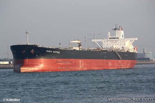
Vessel MAIN IMO: 9387255, MMSI: 314839000 Crude Oil Tanker
Live AIS position:
UTC. Near Ras Sudr),
updated 2025-07-02 10:31:58 UTC.
Find the position of the vessel MAIN on the map. The latter are known coordinates and path.
marine traffic ship tracker show on live map
The current position of vessel MAIN is 29.70578 lat / 32.61225 lng. Updated: 2025-07-02 10:31:58 UTCCurrently sailing under the flag of Barbados
MAIN built in 2008 year
Deadweight:
110448 tDetails:
Last coordinates of the vessel:
2025-07-02 10:31:58 UTC, 29.70578, 32.61225, course: 278, speed: 0