 vesseltracker.com
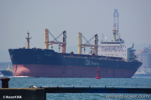
Vessel MALAK IMO: 9446702, MMSI: 314639000 Bulk Carrier
UTC, 12.92982, 74.81303, course: 347, speed: 0
UTC, 12.92976, 74.81307, course: 347, speed: 0
2026-02-23 14:31:52 UTC, 12.92977, 74.81305, course: 347, speed: 0
Live AIS position:
UTC. Near PANAMBUR),
updated 2026-02-23 14:31:52 UTC.
Find the position of the vessel MALAK on the map. The latter are known coordinates and path.
marine traffic ship tracker show on live map
The current position of vessel MALAK is 12.92977 lat / 74.81305 lng. Updated: 2026-02-23 14:31:52 UTCCurrently sailing under the flag of Barbados
MALAK built in 2010 year
Deadweight:
56942 tDetails:
Last coordinates of the vessel:
UTC, 12.92984, 74.81302, course: 347, speed: 0UTC, 12.92982, 74.81303, course: 347, speed: 0
UTC, 12.92976, 74.81307, course: 347, speed: 0
2026-02-23 14:31:52 UTC, 12.92977, 74.81305, course: 347, speed: 0