 vesseltracker.com
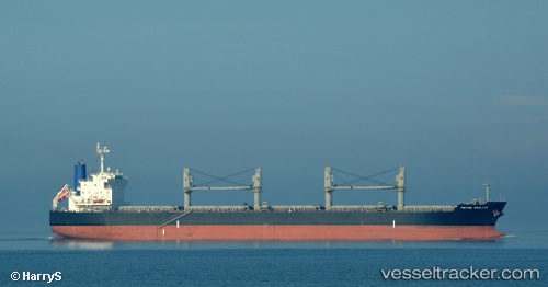
Vessel MALTEZA IMO: 9479034, MMSI: 215882000 Bulk Carrier
UTC, 12.3584, 46.6634, course: 73, speed: 12.7
UTC, 12.4949, 47.1783, course: 67, speed: 12.4
2026-02-23 20:24:25 UTC, 12.655, 47.6517, course: -1, speed: 12
Live AIS position:
UTC. 81 nm NW of Habaching),
updated 2026-02-23 20:24:25 UTC.
Find the position of the vessel MALTEZA on the map. The latter are known coordinates and path.
marine traffic ship tracker show on live map
The current position of vessel MALTEZA is 12.655 lat / 47.6517 lng. Updated: 2026-02-23 20:24:25 UTCCurrently sailing under the flag of Malta
MALTEZA built in 2011 year
Deadweight:
55580 tDetails:
Last coordinates of the vessel:
UTC, 12.2617, 46.3383, course: -1, speed: 12UTC, 12.3584, 46.6634, course: 73, speed: 12.7
UTC, 12.4949, 47.1783, course: 67, speed: 12.4
2026-02-23 20:24:25 UTC, 12.655, 47.6517, course: -1, speed: 12