 vesseltracker.com
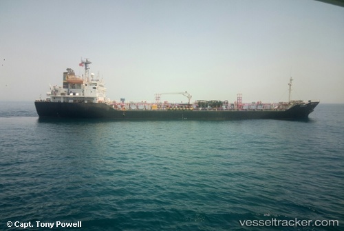
Vessel MARIYA IMO: 9106338, MMSI: 657288500 Oil/Chemical Tanker
UTC, 6.41918, 3.34045, course: 29, speed: 0
UTC, 6.41918, 3.34043, course: 28, speed: 0
2026-03-05 04:06:38 UTC, 6.41917, 3.34043, course: 25, speed: 0
Live Vessel MARIYA Analytics (details, animations, etc.)
Live AIS position: UTC. Near Kirikiri), updated 2026-03-05 04:06:38 UTC.Find the position of the vessel MARIYA on the map. The latter are known coordinates and path.
marine traffic ship tracker show on live map
The current position of vessel MARIYA is 6.41917 lat / 3.34043 lng. Updated: 2026-03-05 04:06:38 UTCCurrently sailing under the flag of Nigeria
Details:
Last coordinates of the vessel:
UTC, 6.41919, 3.34043, course: 29, speed: 0UTC, 6.41918, 3.34045, course: 29, speed: 0
UTC, 6.41918, 3.34043, course: 28, speed: 0
2026-03-05 04:06:38 UTC, 6.41917, 3.34043, course: 25, speed: 0