 vesseltracker.com
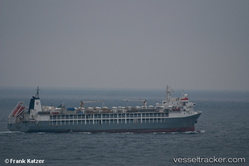
Vessel MAYAR IMO: 9167057, MMSI: 341264001 Livestock Carrier
UTC, 21.45110, 39.16789, course: 300, speed: 0
UTC, 21.45106, 39.16794, course: 300, speed: 0
2026-03-05 01:45:47 UTC, 21.45100, 39.16793, course: 300, speed: 0
Live Vessel MAYAR Analytics (details, animations, etc.)
Live AIS position: UTC. Near Jeddah), updated 2026-03-05 01:45:47 UTC.Find the position of the vessel MAYAR on the map. The latter are known coordinates and path.
marine traffic ship tracker show on live map
The current position of vessel MAYAR is 21.45100 lat / 39.16793 lng. Updated: 2026-03-05 01:45:47 UTCCurrently sailing under the flag of Saint Kitts and Nevis
Details:
Last coordinates of the vessel:
UTC, 21.45109, 39.16788, course: 300, speed: 0UTC, 21.45110, 39.16789, course: 300, speed: 0
UTC, 21.45106, 39.16794, course: 300, speed: 0
2026-03-05 01:45:47 UTC, 21.45100, 39.16793, course: 300, speed: 0