.
vessel '538009237' IMO: 9435064, vesseltracker.com
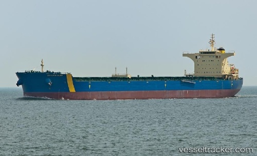
Vessel '538009237' IMO: 9435064, MMSI: 538009237

callsign:
size: x

Live AIS position: UTC. 149 nm NW of Omura), updated 2026-02-02 09:58:59 UTC.

Find the position of the vessel '538009237' on the map. The latter are known coordinates and path.

marine traffic ship tracker show on live map

The current position of vessel '538009237' is 28.53291 lat / 139.90895 lng. Updated: 2026-02-02 09:58:59 UTC
Details:


Last coordinates of the vessel:
2026-02-02 09:58:59 UTC, 28.53291, 139.90895, course: 274, speed: 21.9

Track of the vessel in the last 28 days


Most frequent ports a vessels calls at '538009237' (538009237):

Port Hedland, traffic: 7
Port Headland, traffic: 5
Selat Lombok, traffic: 5
Wu-Sung, traffic: 3
Wusong, traffic: 3
Marmagao, traffic: 2
Mormugao, traffic: 2
Richards Bay, traffic: 2
Taku Bar, traffic: 1
Caldera, traffic: 1
Dagu Bar, traffic: 1
Dagu, traffic: 1
Yeosu, traffic: 1
Yosu, traffic: 1
Panama, traffic: 1

Link to the map:


Find another ship

'538009237' (538009237) last ports (portcalls and passsages)

Yosu | 2024-01-11 06:15:09
Selat Lombok | 2023-12-12 21:37:21
Port Headland | 2023-12-08 16:40:50
Panama | 2022-11-03 20:30:37
Caldera | 2022-10-19 16:46:01
Taku Bar | 2022-09-02 16:30:49
Ta-Ku | 2022-08-31 01:41:44
Dagu Bar | 2022-08-30 22:03:55
Richards Bay | 2022-07-29 02:09:56
Richards Bay | 2022-07-16 16:44:00
Mormugao | 2022-07-01 16:41:58
Mormugao | 2022-06-27 14:08:07
Wusong | 2022-03-24 21:10:45
Port Headland | 2022-02-24 03:25:14
Wusong | 2022-02-01 17:14:15
Selat Lombok | 2021-12-29 08:44:40
Port Hedland | 2021-12-25 18:55:28
Port Headland | 2021-12-24 03:20:34
Selat Lombok | 2021-12-16 05:47:37