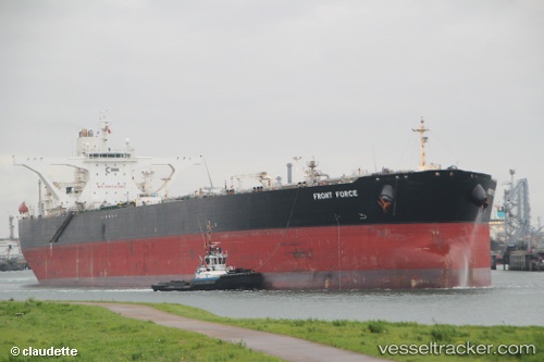
vessel MONICA S IMO: 9292163, Crude Oil Tanker vesseltracker.com
Vessel MONICA S IMO: 9292163, Crude Oil Tanker
MMSI: 352001299 callsign: 3E4038 size: 60x330

Find the position of the vessel MONICA S on the map. The latter are known coordinates and path.

marine traffic ship tracker show on live map

The current position of vessel MONICA S is -54.4456 lat / 28.4042 lng. Updated: 2025-02-06 11:06:02 UTC

Currently sailing under the flag of Panama

MONICA S built in 2004 year

Deadweight:
305442 t

Gross tonnage:
156873
Service entry:
2004-01-01T00:00:00Z
Details:


Last coordinates of the vessel:
UTC, -54.4456, 28.4042, course: 96, speed: 13
2025-02-06 11:06:02 UTC, -54.4456, 28.4042, course: 96, speed: 13

Track of the vessel in the last 14 days


Most frequent ports a vessels calls at MONICA S (352001299):

Sambu, traffic: 17
Singapore, traffic: 9
Az Zarqa Island, traffic: 2
Das Island, traffic: 2
Mutrah, traffic: 2
Sriracha, traffic: 2
Strait Of Gibraltar, traffic: 2
Algeciras, traffic: 1

Link to the map:


Find another ship

MONICA_S (352001299) last ports (portcalls and passsages)

Singapore | 2024-02-23 07:54:30
Strait Of Gibraltar | 2023-09-06 08:21:02
Algeciras | 2023-09-05 06:16:05
Singapore | 2023-08-01 01:44:05
Sambu | 2023-07-30 02:56:43
Singapore | 2023-06-08 01:55:43
Strait Of Gibraltar | 2023-01-25 12:11:18
Sambu | 2022-04-06 06:41:39
Mutrah | 2022-02-06 18:43:30
Sriracha | 2022-01-14 08:19:33
Sambu | 2022-01-11 00:47:31
Sambu | 2022-01-11 00:45:25
Singapore | 2022-01-11 00:36:31
Singapore | 2022-01-10 23:55:35
Sambu | 2022-01-10 23:47:18
Das Island | 2021-12-27 04:30:02
Az Zarqa Island | 2021-12-25 12:04:06
Sambu | 2021-12-12 09:01:40
Sambu | 2021-12-09 23:45:29