 vesseltracker.com
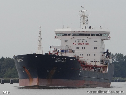
Vessel MORHOLMEN IMO: 9553414, MMSI: 538009993 Chemical/Oil Products Tanker
UTC, -34.75163, -57.78593, course: -1, speed: 0
UTC, -34.75198, -57.78533, course: -1, speed: 0
2026-03-04 14:21:23 UTC, -34.75297, -57.78542, course: -1, speed: 0
Live Vessel MORHOLMEN Analytics (details, animations, etc.)
Live AIS position: UTC. Near La Plata), updated 2026-03-04 14:21:23 UTC.Find the position of the vessel MORHOLMEN on the map. The latter are known coordinates and path.
marine traffic ship tracker show on live map
The current position of vessel MORHOLMEN is -34.75297 lat / -57.78542 lng. Updated: 2026-03-04 14:21:23 UTCCurrently sailing under the flag of Marshall Islands
MORHOLMEN built in 2011 year
Deadweight:
17086 tDetails:
Last coordinates of the vessel:
UTC, -34.73742, -57.73892, course: 260, speed: 9.8UTC, -34.75163, -57.78593, course: -1, speed: 0
UTC, -34.75198, -57.78533, course: -1, speed: 0
2026-03-04 14:21:23 UTC, -34.75297, -57.78542, course: -1, speed: 0