 vesseltracker.com
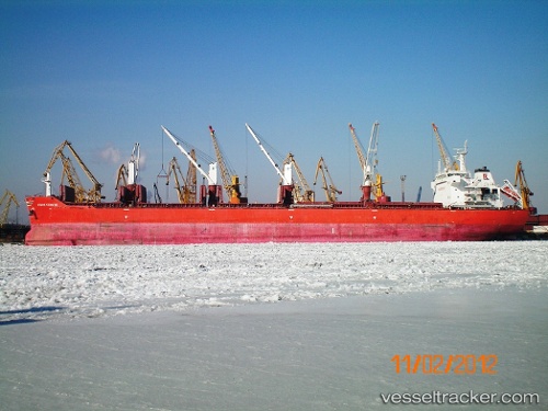
Vessel MOUTON IMO: 9431513, MMSI: 636019919 Bulk Carrier
UTC, 14.97063, 69.46505, course: -1, speed: 10.3
UTC, 15.21478, 69.20975, course: -1, speed: 10.4
2026-02-28 16:35:15 UTC, 15.34335, 69.08253, course: -1, speed: 10.6
Live AIS position:
UTC. 262 nm W of RATNAGIRI),
updated 2026-02-28 16:35:15 UTC.
Find the position of the vessel MOUTON on the map. The latter are known coordinates and path.
marine traffic ship tracker show on live map
The current position of vessel MOUTON is 15.34335 lat / 69.08253 lng. Updated: 2026-02-28 16:35:15 UTCCurrently sailing under the flag of Liberia
MOUTON built in 2010 year
Deadweight:
56819 tDetails:
Last coordinates of the vessel:
UTC, 14.28065, 70.23415, course: 315, speed: 11.2UTC, 14.97063, 69.46505, course: -1, speed: 10.3
UTC, 15.21478, 69.20975, course: -1, speed: 10.4
2026-02-28 16:35:15 UTC, 15.34335, 69.08253, course: -1, speed: 10.6