 vesseltracker.com
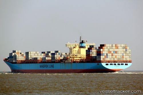
Vessel MSC ABY IMO: 9166778, MMSI: 636020730 Container Ship
UTC, 23.17341, 62.52933, course: -1, speed: 18.7
UTC, 23.07731, 63.03052, course: -1, speed: 18.2
2026-02-27 16:25:56 UTC, 22.91593, 63.92367, course: -1, speed: 13.1
Live AIS position:
UTC. 202 nm SW of Kiamari),
updated 2026-02-27 16:25:56 UTC.
Find the position of the vessel MSC ABY on the map. The latter are known coordinates and path.
marine traffic ship tracker show on live map
The current position of vessel MSC ABY is 22.91593 lat / 63.92367 lng. Updated: 2026-02-27 16:25:56 UTCCurrently sailing under the flag of Liberia
MSC ABY built in 1999 year
Deadweight:
110387 tDetails:
Last coordinates of the vessel:
UTC, 23.27407, 61.92065, course: -1, speed: 19.1UTC, 23.17341, 62.52933, course: -1, speed: 18.7
UTC, 23.07731, 63.03052, course: -1, speed: 18.2
2026-02-27 16:25:56 UTC, 22.91593, 63.92367, course: -1, speed: 13.1