 vesseltracker.com
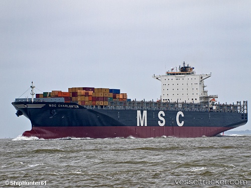
Vessel MSC CHARLESTON IMO: 9299537, MMSI: 255806367 Container Ship
UTC, -7.62978, -3.51148, course: 141, speed: 18.8
UTC, -7.85723, -3.33814, course: 141, speed: 18.6
2026-02-22 16:16:59 UTC, -8.55213, -2.81813, course: 143, speed: 18.8
Live AIS position:
UTC. Open sea, approx. 429 nm off the nearest listed port),
updated 2026-02-22 16:16:59 UTC.
Find the position of the vessel MSC CHARLESTON on the map. The latter are known coordinates and path.
marine traffic ship tracker show on live map
The current position of vessel MSC CHARLESTON is -8.55213 lat / -2.81813 lng. Updated: 2026-02-22 16:16:59 UTCCurrently sailing under the flag of Portugal (MAR)
MSC CHARLESTON built in 2006 year
Deadweight:
105014 tDetails:
Last coordinates of the vessel:
UTC, -6.82619, -4.10480, course: 141, speed: 18.1UTC, -7.62978, -3.51148, course: 141, speed: 18.8
UTC, -7.85723, -3.33814, course: 141, speed: 18.6
2026-02-22 16:16:59 UTC, -8.55213, -2.81813, course: 143, speed: 18.8