 vesseltracker.com
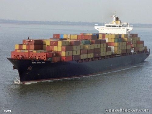
Vessel MSC ENGLAND IMO: 9232890, MMSI: 636019395 Container Ship
UTC, 38.20284, 11.68467, course: 80, speed: 10
UTC, 38.28092, 12.24971, course: 80, speed: 9.9
2026-02-22 13:51:49 UTC, 38.31660, 12.53938, course: 78, speed: 10.3
Live AIS position:
UTC. 16 nm N of Bonagia),
updated 2026-02-22 13:51:49 UTC.
Find the position of the vessel MSC ENGLAND on the map. The latter are known coordinates and path.
marine traffic ship tracker show on live map
The current position of vessel MSC ENGLAND is 38.31660 lat / 12.53938 lng. Updated: 2026-02-22 13:51:49 UTCCurrently sailing under the flag of Liberia
MSC ENGLAND built in 2001 year
Deadweight:
51020 tDetails:
Last coordinates of the vessel:
UTC, 38.15096, 11.25309, course: 81, speed: 10UTC, 38.20284, 11.68467, course: 80, speed: 10
UTC, 38.28092, 12.24971, course: 80, speed: 9.9
2026-02-22 13:51:49 UTC, 38.31660, 12.53938, course: 78, speed: 10.3