 vesseltracker.com
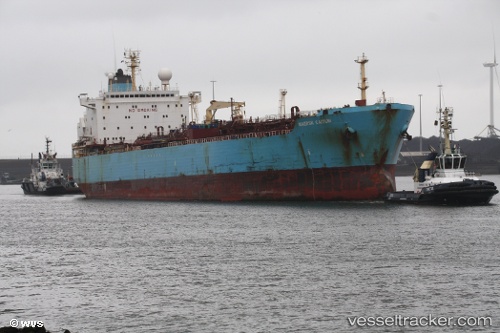
Vessel MULAND IMO: 9133082, MMSI: 351840000 Chemical/Oil Products Tanker
UTC, 25.47167, 55.47667, course: -1, speed: 0
UTC, 25.47167, 55.47667, course: -1, speed: 0
2026-02-26 01:51:45 UTC, 25.47167, 55.47667, course: -1, speed: 0
Live AIS position:
UTC. Near HAMRIYA),
updated 2026-02-26 01:51:45 UTC.
Find the position of the vessel MULAND on the map. The latter are known coordinates and path.
marine traffic ship tracker show on live map
The current position of vessel MULAND is 25.47167 lat / 55.47667 lng. Updated: 2026-02-26 01:51:45 UTCCurrently sailing under the flag of Panama
MULAND built in 1997 year
Deadweight:
44936 tDetails:
Last coordinates of the vessel:
UTC, 25.47167, 55.47667, course: -1, speed: 0UTC, 25.47167, 55.47667, course: -1, speed: 0
UTC, 25.47167, 55.47667, course: -1, speed: 0
2026-02-26 01:51:45 UTC, 25.47167, 55.47667, course: -1, speed: 0