 vesseltracker.com
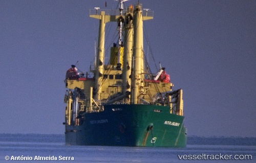
Vessel MUTIA LADJONI 9 IMO: 9016167, MMSI: 525003305 General Cargo Ship
UTC, 0.17757, 117.52048, course: -1, speed: 0
UTC, 0.17748, 117.52039, course: -1, speed: 0
2026-02-22 12:09:11 UTC, 0.17736, 117.52037, course: -1, speed: 0.1
Live AIS position:
UTC. Near Tanjung Merangas),
updated 2026-02-22 12:09:11 UTC.
Find the position of the vessel MUTIA LADJONI 9 on the map. The latter are known coordinates and path.
marine traffic ship tracker show on live map
The current position of vessel MUTIA LADJONI 9 is 0.17736 lat / 117.52037 lng. Updated: 2026-02-22 12:09:11 UTCCurrently sailing under the flag of Indonesia
MUTIA LADJONI 9 built in 1991 year
Deadweight:
7194 tDetails:
Last coordinates of the vessel:
UTC, 0.17775, 117.52145, course: -1, speed: 0UTC, 0.17757, 117.52048, course: -1, speed: 0
UTC, 0.17748, 117.52039, course: -1, speed: 0
2026-02-22 12:09:11 UTC, 0.17736, 117.52037, course: -1, speed: 0.1