 vesseltracker.com
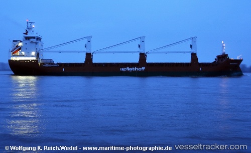
Vessel Maasgracht IMO: 9571492, MMSI: 246766000 General Cargo Ship
UTC, -13.39217, 143.89799, course: 151, speed: 12
UTC, -13.54927, 143.98581, course: 149, speed: 11.8
2026-02-22 09:27:24 UTC, -13.86898, 144.23286, course: 140, speed: 11.6
Live AIS position:
UTC. 85 nm NW of LIZARD ISLAND),
updated 2026-02-22 09:27:24 UTC.
Find the position of the vessel Maasgracht on the map. The latter are known coordinates and path.
marine traffic ship tracker show on live map
The current position of vessel Maasgracht is -13.86898 lat / 144.23286 lng. Updated: 2026-02-22 09:27:24 UTCCurrently sailing under the flag of Netherlands
Maasgracht built in 2011 year
Deadweight:
11759 tDetails:
Last coordinates of the vessel:
UTC, -12.90333, 143.67667, course: -1, speed: 12UTC, -13.39217, 143.89799, course: 151, speed: 12
UTC, -13.54927, 143.98581, course: 149, speed: 11.8
2026-02-22 09:27:24 UTC, -13.86898, 144.23286, course: 140, speed: 11.6