 vesseltracker.com
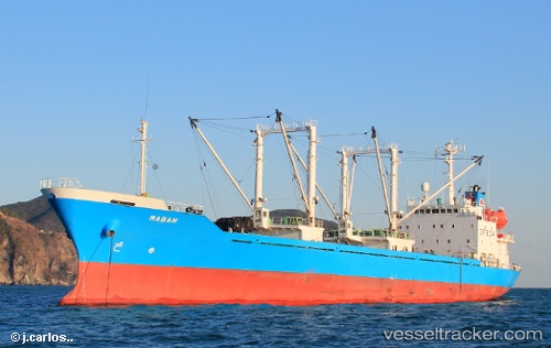
Vessel Mabah IMO: 9105358, MMSI: 354493000 Refrigerated Cargo Ship
UTC, 6.98801, 158.15376, course: 98, speed: 0.1
UTC, 6.98799, 158.15375, course: 96, speed: 0.1
2026-02-22 09:24:25 UTC, 6.98831, 158.15367, course: 94, speed: 0
Live AIS position:
UTC. 64 nm W of Ponape),
updated 2026-02-22 09:24:25 UTC.
Find the position of the vessel Mabah on the map. The latter are known coordinates and path.
marine traffic ship tracker show on live map
The current position of vessel Mabah is 6.98831 lat / 158.15367 lng. Updated: 2026-02-22 09:24:25 UTCDetails:
Last coordinates of the vessel:
UTC, 6.98798, 158.15366, course: 81, speed: 0UTC, 6.98801, 158.15376, course: 98, speed: 0.1
UTC, 6.98799, 158.15375, course: 96, speed: 0.1
2026-02-22 09:24:25 UTC, 6.98831, 158.15367, course: 94, speed: 0