 vesseltracker.com
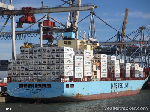
Vessel Maersk Buton IMO: 9392925, MMSI: 565971000 Container Ship
UTC, 18.85049, -74.59954, course: 29, speed: 17.4
UTC, 19.11833, -74.44333, course: -1, speed: 18
2026-02-21 02:17:13 UTC, 19.85667, -74.06167, course: -1, speed: 18
Live AIS position:
UTC. 24 nm S of Punta de Maisi),
updated 2026-02-21 02:17:13 UTC.
Find the position of the vessel Maersk Buton on the map. The latter are known coordinates and path.
marine traffic ship tracker show on live map
The current position of vessel Maersk Buton is 19.85667 lat / -74.06167 lng. Updated: 2026-02-21 02:17:13 UTCCurrently sailing under the flag of Singapore
Maersk Buton built in 2008 year
Deadweight:
43123 tDetails:
Last coordinates of the vessel:
UTC, 18.03167, -74.86833, course: -1, speed: 18UTC, 18.85049, -74.59954, course: 29, speed: 17.4
UTC, 19.11833, -74.44333, course: -1, speed: 18
2026-02-21 02:17:13 UTC, 19.85667, -74.06167, course: -1, speed: 18