 vesseltracker.com
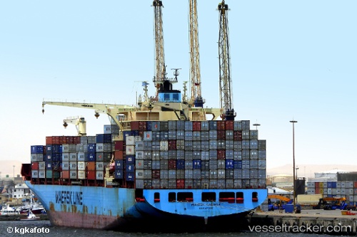
Vessel Maersk Cabinda IMO: 9525493, MMSI: 566491000 Container Ship
UTC, 6.14401, 1.28707, course: 257, speed: 0
UTC, 6.14395, 1.28720, course: 258, speed: 0
2026-02-21 03:21:27 UTC, 6.10342, 1.31929, course: 157, speed: 6.2
Live AIS position:
UTC. Near Ablogamé),
updated 2026-02-21 03:21:27 UTC.
Find the position of the vessel Maersk Cabinda on the map. The latter are known coordinates and path.
marine traffic ship tracker show on live map
The current position of vessel Maersk Cabinda is 6.10342 lat / 1.31929 lng. Updated: 2026-02-21 03:21:27 UTCCurrently sailing under the flag of Singapore
Maersk Cabinda built in 2012 year
Deadweight:
61547 tDetails:
Last coordinates of the vessel:
UTC, 6.14401, 1.28714, course: 257, speed: 0UTC, 6.14401, 1.28707, course: 257, speed: 0
UTC, 6.14395, 1.28720, course: 258, speed: 0
2026-02-21 03:21:27 UTC, 6.10342, 1.31929, course: 157, speed: 6.2