 vesseltracker.com
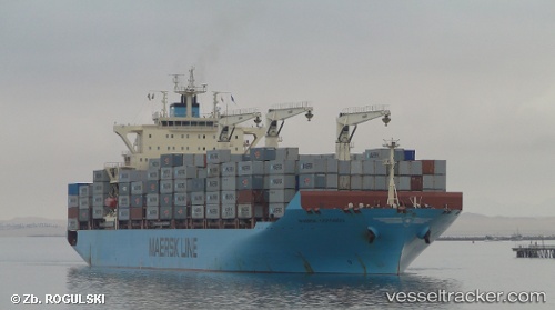
Vessel Maersk Cotonou IMO: 9525297, MMSI: 564306000 Container Ship
UTC, -34.39544, 24.02612, course: 261, speed: 17.7
UTC, -34.51735, 23.25699, course: 251, speed: 17.8
2026-02-21 03:47:35 UTC, -34.61988, 22.88585, course: 251, speed: 18
Live AIS position:
UTC. 36 nm S of Knysna),
updated 2026-02-21 03:47:35 UTC.
Find the position of the vessel Maersk Cotonou on the map. The latter are known coordinates and path.
marine traffic ship tracker show on live map
The current position of vessel Maersk Cotonou is -34.61988 lat / 22.88585 lng. Updated: 2026-02-21 03:47:35 UTCDetails:
Last coordinates of the vessel:
UTC, -34.28510, 24.97890, course: 257, speed: 16.9UTC, -34.39544, 24.02612, course: 261, speed: 17.7
UTC, -34.51735, 23.25699, course: 251, speed: 17.8
2026-02-21 03:47:35 UTC, -34.61988, 22.88585, course: 251, speed: 18