 vesseltracker.com
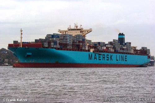
Vessel Maersk Elba IMO: 9458078, MMSI: 219198000 Container Ship
UTC, 30.14725, 123.36235, course: 175, speed: 20.8
UTC, 29.88093, 123.39493, course: 180, speed: 22.6
2026-02-21 02:09:00 UTC, 30.32282, 123.54150, course: 271, speed: 19
Live AIS position:
UTC. 56 nm SE of Lü-hua Shan),
updated 2026-02-21 02:09:00 UTC.
Find the position of the vessel Maersk Elba on the map. The latter are known coordinates and path.
marine traffic ship tracker show on live map
The current position of vessel Maersk Elba is 30.32282 lat / 123.54150 lng. Updated: 2026-02-21 02:09:00 UTCCurrently sailing under the flag of Denmark
Maersk Elba built in 2011 year
Deadweight:
142105 tDetails:
Last coordinates of the vessel:
UTC, 30.13844, 123.54123, course: 85, speed: 1UTC, 30.14725, 123.36235, course: 175, speed: 20.8
UTC, 29.88093, 123.39493, course: 180, speed: 22.6
2026-02-21 02:09:00 UTC, 30.32282, 123.54150, course: 271, speed: 19