 vesseltracker.com
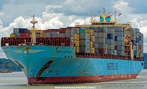
Vessel Maersk Garonne IMO: 9235579, MMSI: 563077400 Container Ship
UTC, 33.51249, -57.10591, course: 286, speed: 17.2
UTC, 33.69123, -57.89972, course: 285, speed: 17
2026-02-21 02:53:07 UTC, 33.88276, -58.72267, course: 283, speed: 16.7
Live AIS position:
UTC. 313 nm E of Saint George),
updated 2026-02-21 02:53:07 UTC.
Find the position of the vessel Maersk Garonne on the map. The latter are known coordinates and path.
marine traffic ship tracker show on live map
The current position of vessel Maersk Garonne is 33.88276 lat / -58.72267 lng. Updated: 2026-02-21 02:53:07 UTCCurrently sailing under the flag of Singapore
Maersk Garonne built in 2003 year
Deadweight:
61636 tDetails:
Last coordinates of the vessel:
UTC, 33.41467, -56.62413, course: 284, speed: 17.2UTC, 33.51249, -57.10591, course: 286, speed: 17.2
UTC, 33.69123, -57.89972, course: 285, speed: 17
2026-02-21 02:53:07 UTC, 33.88276, -58.72267, course: 283, speed: 16.7