 vesseltracker.com
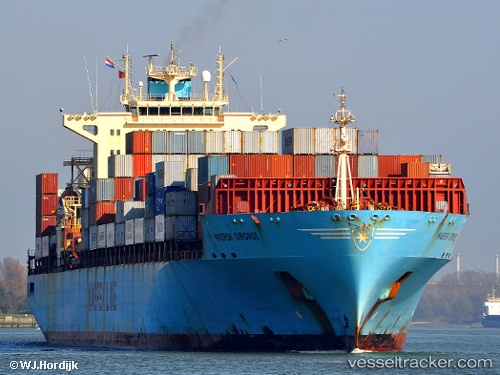
Vessel Maersk Gironde IMO: 9235555, MMSI: 563076300 Container Ship
UTC, 54.77854, 13.56199, course: 270, speed: 15.5
UTC, 54.78154, 12.75679, course: 233, speed: 11.8
2026-02-21 03:22:44 UTC, 54.66817, 12.44797, course: 236, speed: 12.4
Live AIS position:
UTC. 16 nm N of Wieck auf dem Dass),
updated 2026-02-21 03:22:44 UTC.
Find the position of the vessel Maersk Gironde on the map. The latter are known coordinates and path.
marine traffic ship tracker show on live map
The current position of vessel Maersk Gironde is 54.66817 lat / 12.44797 lng. Updated: 2026-02-21 03:22:44 UTCCurrently sailing under the flag of Singapore
Maersk Gironde built in 2002 year
Deadweight:
61636 tDetails:
Last coordinates of the vessel:
UTC, 54.63978, 14.34641, course: 287, speed: 17UTC, 54.77854, 13.56199, course: 270, speed: 15.5
UTC, 54.78154, 12.75679, course: 233, speed: 11.8
2026-02-21 03:22:44 UTC, 54.66817, 12.44797, course: 236, speed: 12.4