 vesseltracker.com
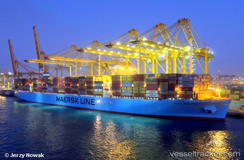
Vessel Maersk Hong Kong IMO: 9784257, MMSI: 563017800 Container Ship
UTC, 4.10667, -12.87000, course: -1, speed: 21
UTC, 3.40667, -12.39167, course: -1, speed: 21
2026-02-21 03:26:12 UTC, 3.15165, -12.21342, course: 146, speed: 20.7
Live AIS position:
UTC. 207 nm SW of Buchanan),
updated 2026-02-21 03:26:12 UTC.
Find the position of the vessel Maersk Hong Kong on the map. The latter are known coordinates and path.
marine traffic ship tracker show on live map
The current position of vessel Maersk Hong Kong is 3.15165 lat / -12.21342 lng. Updated: 2026-02-21 03:26:12 UTCDetails:
Last coordinates of the vessel:
UTC, 4.72333, -13.29333, course: -1, speed: 21UTC, 4.10667, -12.87000, course: -1, speed: 21
UTC, 3.40667, -12.39167, course: -1, speed: 21
2026-02-21 03:26:12 UTC, 3.15165, -12.21342, course: 146, speed: 20.7