 vesseltracker.com
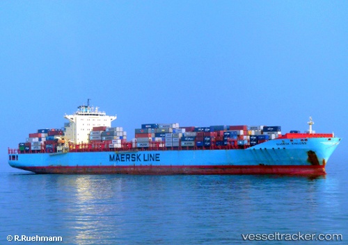
Vessel Maersk Kinloss IMO: 9333022, MMSI: 338241000 Container Ship
UTC, 33.49500, 149.14000, course: -1, speed: 21
UTC, 33.60833, 148.23167, course: -1, speed: 18
2026-02-21 08:25:28 UTC, 33.68807, 147.71692, course: 283, speed: 12.8
Live AIS position:
UTC. 250 nm SE of Santa Venera),
updated 2026-02-21 08:25:28 UTC.
Find the position of the vessel Maersk Kinloss on the map. The latter are known coordinates and path.
marine traffic ship tracker show on live map
The current position of vessel Maersk Kinloss is 33.68807 lat / 147.71692 lng. Updated: 2026-02-21 08:25:28 UTCCurrently sailing under the flag of USA
Maersk Kinloss built in 2008 year
Deadweight:
84835 tDetails:
Last coordinates of the vessel:
UTC, 33.40127, 150.08925, course: 276, speed: 20.1UTC, 33.49500, 149.14000, course: -1, speed: 21
UTC, 33.60833, 148.23167, course: -1, speed: 18
2026-02-21 08:25:28 UTC, 33.68807, 147.71692, course: 283, speed: 12.8