 vesseltracker.com
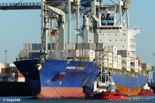
Vessel Maersk Niteroi IMO: 9434943, MMSI: 477634900 Container Ship
Live AIS position:
UTC. Near Bremerhaven-Speckenbüttel),
updated 2025-05-14 07:02:20 UTC.
Find the position of the vessel Maersk Niteroi on the map. The latter are known coordinates and path.
marine traffic ship tracker show on live map
The current position of vessel Maersk Niteroi is 53.58938 lat / 8.52108 lng. Updated: 2025-05-14 07:02:20 UTCCurrently sailing under the flag of Hong Kong
Maersk Niteroi built in 2009 year
Deadweight:
33411 tDetails:
Last coordinates of the vessel:
2025-05-14 07:02:20 UTC, 53.58938, 8.52108, course: 22, speed: 0.9