 vesseltracker.com
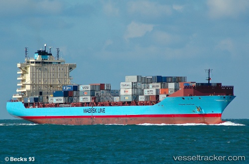
Vessel Maersk Norfolk IMO: 9356139, MMSI: 219225000 Container Ship
UTC, 36.15233, -5.39803, course: 5, speed: 5.8
UTC, 36.16833, -5.40583, course: 65, speed: 0.2
2026-02-21 07:56:03 UTC, 36.16843, -5.40653, course: 72, speed: 0.2
Live AIS position:
UTC. Near Palmones),
updated 2026-02-21 07:56:03 UTC.
Find the position of the vessel Maersk Norfolk on the map. The latter are known coordinates and path.
marine traffic ship tracker show on live map
The current position of vessel Maersk Norfolk is 36.16843 lat / -5.40653 lng. Updated: 2026-02-21 07:56:03 UTCCurrently sailing under the flag of Denmark
Maersk Norfolk built in 2008 year
Deadweight:
35205 tDetails:
Last coordinates of the vessel:
UTC, 36.05213, -5.33315, course: 277, speed: 9.4UTC, 36.15233, -5.39803, course: 5, speed: 5.8
UTC, 36.16833, -5.40583, course: 65, speed: 0.2
2026-02-21 07:56:03 UTC, 36.16843, -5.40653, course: 72, speed: 0.2