 vesseltracker.com
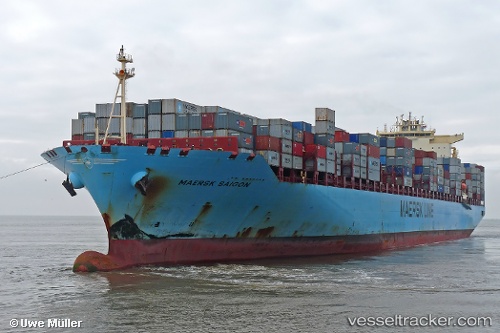
Vessel Maersk Saigon IMO: 9303534, MMSI: 563032700 Container Ship
UTC, 12.18667, -79.78833, course: -1, speed: 14
UTC, 12.52667, -79.76167, course: -1, speed: 14
2026-02-21 08:09:33 UTC, 13.08500, -79.72167, course: -1, speed: 14
Live AIS position:
UTC. 120 nm E of San Andrés),
updated 2026-02-21 08:09:33 UTC.
Find the position of the vessel Maersk Saigon on the map. The latter are known coordinates and path.
marine traffic ship tracker show on live map
The current position of vessel Maersk Saigon is 13.08500 lat / -79.72167 lng. Updated: 2026-02-21 08:09:33 UTCCurrently sailing under the flag of Singapore
Maersk Saigon built in 2006 year
Deadweight:
108250 tDetails:
Last coordinates of the vessel:
UTC, 11.69500, -79.82500, course: -1, speed: 14UTC, 12.18667, -79.78833, course: -1, speed: 14
UTC, 12.52667, -79.76167, course: -1, speed: 14
2026-02-21 08:09:33 UTC, 13.08500, -79.72167, course: -1, speed: 14