 vesseltracker.com
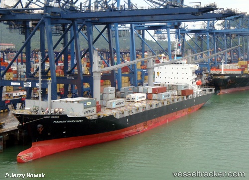
Vessel Maersk Wakayama IMO: 9550357, MMSI: 370837000 Container Ship
Live AIS position:
UTC. Near Bahía Las Minas),
updated 2023-03-28 07:04:45 UTC.
Find the position of the vessel Maersk Wakayama on the map. The latter are known coordinates and path.
marine traffic ship tracker show on live map
The current position of vessel Maersk Wakayama is 9.51473 lat / -79.89490 lng. Updated: 2023-03-28 07:04:45 UTCCurrently sailing under the flag of Panama
Maersk Wakayama built in 2010 year
Deadweight:
21442 tDetails:
Last coordinates of the vessel:
2023-03-28 07:04:45 UTC, 9.51473, -79.89490, course: 196, speed: 6.4