 vesseltracker.com
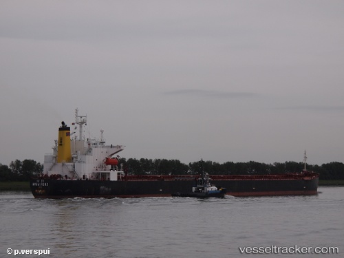
Vessel Maha Roos IMO: 9231004, MMSI: 419000124 Bulk Carrier
UTC, -7.33623, 40.99638, course: 159, speed: 10.8
UTC, -7.74210, 41.12495, course: 159, speed: 11.3
2026-02-21 17:31:48 UTC, -8.02287, 41.21350, course: 159, speed: 11.8
Live AIS position:
UTC. 131 nm E of Ikwiriri),
updated 2026-02-21 17:31:48 UTC.
Find the position of the vessel Maha Roos on the map. The latter are known coordinates and path.
marine traffic ship tracker show on live map
The current position of vessel Maha Roos is -8.02287 lat / 41.21350 lng. Updated: 2026-02-21 17:31:48 UTCDetails:
Last coordinates of the vessel:
UTC, -6.94697, 40.86535, course: 158, speed: 11UTC, -7.33623, 40.99638, course: 159, speed: 10.8
UTC, -7.74210, 41.12495, course: 159, speed: 11.3
2026-02-21 17:31:48 UTC, -8.02287, 41.21350, course: 159, speed: 11.8