 vesseltracker.com
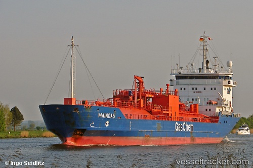
Vessel Maingas IMO: 9108843, MMSI: 636016595 Lpg Tanker
Live AIS position:
UTC. Near Tarabulus),
updated 2025-11-30 04:55:44 UTC.
Find the position of the vessel Maingas on the map. The latter are known coordinates and path.
marine traffic ship tracker show on live map
The current position of vessel Maingas is 32.90745 lat / 13.18899 lng. Updated: 2025-11-30 04:55:44 UTCCurrently sailing under the flag of Liberia
Maingas built in 2001 year
Deadweight:
3467 tDetails:
Last coordinates of the vessel:
2025-11-30 04:55:44 UTC, 32.90745, 13.18899, course: 242, speed: 0